|
"What lies behind us and what lies before us are tiny matters compared to what lies
within us." - Ralph Waldo Emerson
Objective
The purpose of this assignment is twofold: (1) compute the bearings of a
traverse based on survey data and a reference bearing, and (2) develop a spreadsheet to compute the
area of the traverse and the x and y coordinates of the points on
a traverse.
You must submit the cover
sheet for the assignment, printouts of your
spreadsheet for Parts 1 and 2. Also, submit
your spreadsheets for Parts 1 and 2 to Canvas. You
must follow the Excel format.
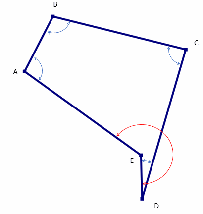
Part 1. A five-sided closed field traverse has the following distances in feet:
AB = 285.13', BC = 610.24', CD = 720.35', DE = 203.03', and EA = 647.25'. The interior
angles are as follows (measured as angles to the right):
A = 100° 45' 37", B = 101° 34' 24", C = 89° 03' 28", D = 17° 12' 59", and E =
231° 23' 43". The bearing of AB is N 26° 09' 40" E.
Determine the bearings of each side and then use your traverse spreadsheet to compute the corrected and balanced latitudes and
departures for the traverse. Show all work to determine the
bearing of each side, following the homework format.
See the diagram below to visualize the orientation of the traverse and the
location of the interior angles.
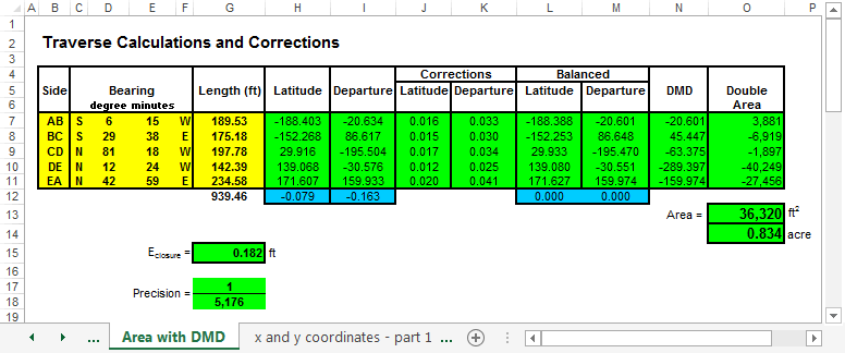
Part 2. This workbook should supplement your
work from Assignment 10 to include the
double meridian distance
(DMA), the double area, and the x- and y-coordinate calculations. Your traverse workbook will be used in your design for the detention pond
project. The workbook should compute latitudes and departures from given
bearings and distances, DMDs, and the area of the
closed, balanced traverse. The figure below shows a typical spreadsheet layout for
this problem. Your spreadsheet may look different if it provides the same
input and parameter definitions. Note that the directions N/S and E/W are in
individual cells. Also, the values for degrees and minutes are in separate
cells.
Make a copy of the previous spreadsheet and use it to compute
the x and y coordinates of the points in your traverse for given
values of point A and the plot of ther traverse area. The figure below shows a typical spreadsheet layout for this
problem. Your spreadsheet may appear differently if it uses the same
input and parameter definitions.
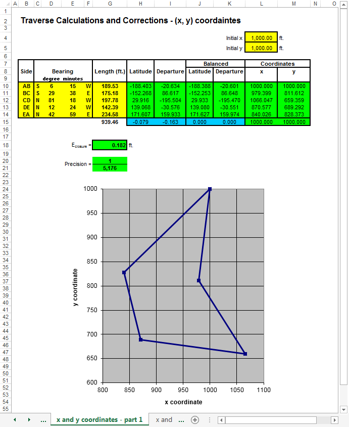
Use your traverse spreadsheet to calculate the latitudes and departures.
Balance the latitudes and departures using the compass rule. Then, compute the
area using DMD, determine the x- and y-coordinates, assuming point A is located
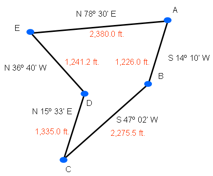
at (3,000, 3,000). Finally, plot the traverse area for the traverse shown below.
Cover sheet for homework
This website was originally
developed by
Charles Camp for
CIVL
1112.
This site is maintained by the
Department of Civil Engineering
at the University of Memphis.
Your comments and questions are welcomed.
|