|
“To map out a course of action and follow it to an end
requires courage” - Ralph Waldo Emerson
Background: Your
firm (lab group) is competing with other local
firms for the right to be the exclusive
surveying firm of The University of Memphis.
Your audience is Dr.
Russell Deaton,
Dean, Herff College of Engineering, University
of Memphis. Your group's technical report and
presentation will demonstrate your surveying
skills and allow you to communicate directly
with the university administrators charged with
selecting a surveying company. Your proposal
will be a technical report and a formal
presentation with visual aids. Information on
these components will be presented during class
and in the lab, and technical report-writing
information is also available on our website.
Approach: Develop a map of your site (assigned to you in
the lab) using ArcMap. Your map must include the geo-referenced aerial photographs of Shelby
County as a background image; 1-foot contours lines developed from elevation
data measured in the lab; the site's four corner points; a North arrow; a scale with 50-foot increments; and labels for your site
number, the major streets in the area, and the site's four corner point.
Using ArcGIS, develop a map showing your site's contour lines.
-
Develop a map of your site using the Shelby County aerials as a
background and contour lines developed from your data
(click
here for an example of the map).
-
Download the zipped geodatabase file for your site. Click on
your site name from the list below:
Unzip the file into your local Documents/ArcGIS
folder.
-
Add all the layers from the site geodatabase over the Shelby
County aerials (click
here
for an example of adding data to a map).
-
Add the site elevation data measured in the lab into the
gridline layer. First, click on the Editor button on the top menu of ArcGIS.
If the Edit toolbar is not visible, click on Customize →
Toolbars → Editor.
-
Select the sitegridpoint point coverage for editing and
click OK.
-
On the far right of the the ArcGIS window under the Create
Features window, select sitegridpoint and then under the
Construction Tool section of the window (near the bottom of the screen)
select Point. You are now ready to edit point in the point coverage.
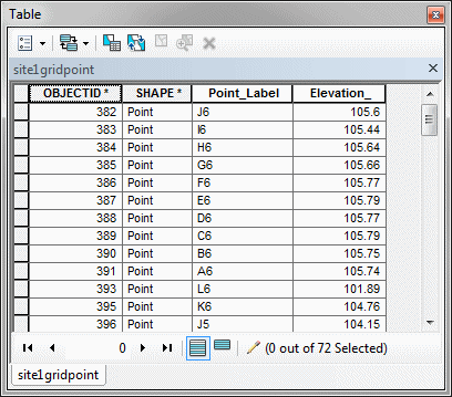
- Right-click on the sitegridpoint layer in the Table of
Contents and click on Open Attribute Table. You should notice the
four data fields available. We are interested in Point_Label
and Elevation.
-
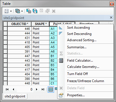
Right-click on the Point_Label field and
Sort Ascending to order the labels of the surveying grid points.
-
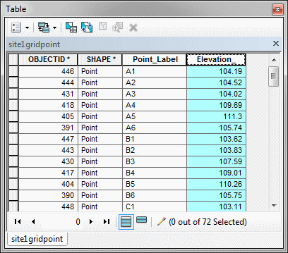
With the Attribute Table sorted and the Editor on, enter
your elevation data from your topographic survey into the appropriate cells
of the Elevation field of the table.
-
After all the elevation data has been entered, click on the Editor
button on the top menu of the ArcGIS and then Save Edits and then
Stop Editing.
-
Use ArcGIS tools to develop contour lines for your site
elevation data
(click
here for an example of
constructing a contour line map).
-
To develop a map of your site with the
contours, click on View on the top menu of the ArcGIS and
click on Layout View.
-
Add a North arrow; a scale with 50-foot increments; and
labels for your site number, the major streets in the area, and the site's
four corner point (click
here for
an example
of adding map features)
-
The contour line map of your site should look similar to the
following map:
-
Export the map images from ArcGIS by clicking on
File on the top menu of the ArcGIS and
clicking on Export Map... (I suggest that you export your map in
*.jpg format)
|